Category:138 Project Development Chronology: Difference between revisions
m article construction |
m article construction |
||
| Line 106: | Line 106: | ||
|style="background:#fff8e7" align="center"|[[media:2001 back map.pdf|2001 road map (back)]] | |style="background:#fff8e7" align="center"|[[media:2001 back map.pdf|2001 road map (back)]] | ||
|} | |} | ||
[[image:138 govs.jpg|right|140px|thumb|<center>'''Pictures of governors have been on the highway map since the 1950s.'''</center>]] | |||
====Speaking of road maps==== | ====Speaking of road maps==== | ||
'''Most common title for MoDOT’s road map:''' “Missouri Official Highway Map” was used for the 1938 and 1939 editions as well as every one since 1961. | '''Most common title for MoDOT’s road map:''' “Missouri Official Highway Map” was used for the 1938 and 1939 editions as well as every one since 1961. | ||
| Line 127: | Line 129: | ||
'''Size:''' The 2007 map is approx. 29 in. x 39.5 in., having an area about 24% larger than most previous maps. Yes, most of the map's print is larger than previous maps' print, too. | '''Size:''' The 2007 map is approx. 29 in. x 39.5 in., having an area about 24% larger than most previous maps. Yes, most of the map's print is larger than previous maps' print, too. | ||
'''How many printed?''' Over 3 million printed and distributed, arguably Missouri's most popular state publication. | '''How many printed?''' Over 3 million 2007 maps were printed and distributed, arguably Missouri's most popular state publication. | ||
Revision as of 12:39, 3 October 2008
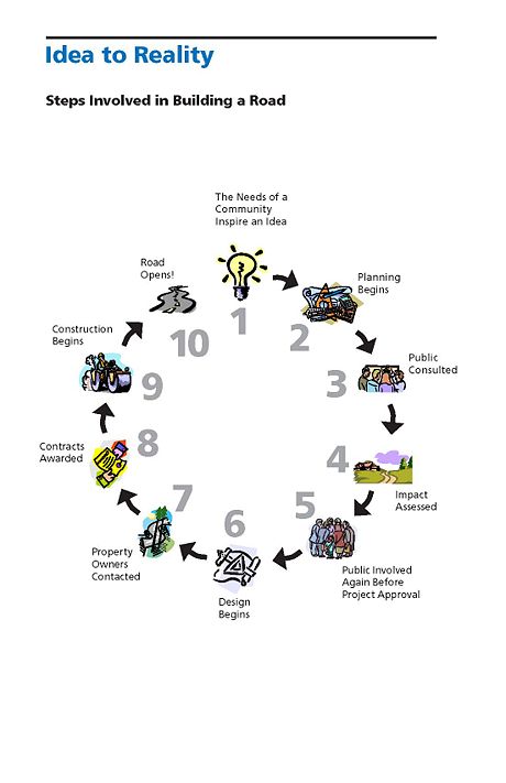
This article is a brief outline of the process involved in the path of an improvement project from the initial identification of a “need” to a completed project serving the public.
138.1 Idea to Meet Transportation Need
MoDOT considers an area’s safety concerns, growth, traffic patterns and transportation needs. When a need is identified, MoDOT meets with local government, community leaders and transportation users to discuss the project.

At this stage, MoDOT announces to the public what improvement is proposed to address the need. Response from the interested groups and individuals is collected and considered as development of the improvement continues.
MoDOT proposes and evaluates several possible improvement locations. The Missouri Highway and Transportation Commission reviews public comments and other information concerning the proposed improvement before further development of the improvement.
Teams of MoDOT specialists evaluate the improvement’s impact on wetlands, wildlife, homeowners, businesses, etc. The proposed improvement is also sent to the Federal Highway Administration (FHWA) for approval. Other Federal agencies, such as the Environmental Protection Agency, Department of Interior, Corps of Engineers, Federal Emergency Management Agency and State agencies such as the Missouri Department of Natural Resources and the State Emergency Management Agency may need to grant approval for the improvement to proceed.

138.5 Public Consulted Again Before Project Approval
MoDOT holds additional public hearings to gather public comments during development of the improvement. The Commission gives final approval for the project’s location and design details.
138.6 Design
138.6.1 Value Engineering. Value Engineering (VE) helps assure the full value of every transportation tax dollar is realized. In highway construction it encourages designers to provide cost efficient designs and contractors to employ innovative construction methods to reduce costs.
138.6.2 Preliminary Plans. A preliminary plan shows preliminary geometric details and includes design criteria, proposed alignment, profile, tentative grade, tentative right of way, schematic intersection or interchange layouts, bypasses and pertinent topographic features. The preliminary plan develops and conveys basic design criteria, basic geometric details and recommendations upon which the detail plans are to be developed.
138.6.3 Surveys. A survey physically establishes the location in the field in accord with the approved location. The survey includes the location of all man-made features in relation to the established centerline and also includes elevations on National Geodetic Survey (NGS) or United States Geodetic Survey (USGS) datum necessary to locate grades, culverts, bridges, and to compute excavation quantities.
138.6.4 Right of Way Plans. Detail plans are prepared to provide the information and details necessary to construct transportation improvements to criteria required to address the need of the improvement. The plans show all existing topographic features and the disposition of existing improvements affected by the proposed construction and indicates the right of way necessary to allow room for the improvement’s construction and maintenance, and in sufficient detail to write deeds and acquire the right of way to the dimensions shown on the plans.
138.6.5 Basic Design Criteria
Traffic. Whether the road to be improved is a major or minor roadway and its level of anticipated traffic are key elements in determining basic design controls for the improvement. Improvement projects on interstate roadways are designed for traffic projected 20 years beyond the date design of the improvement is completed. All other roadway improvements are designed for traffic projected 20 years beyond the date of construction begins.
Anticipated Posted Speed. It is desirable to select design criteria for roadway improvement projects that reflect the anticipated posted speed (previously called "design speed") of the completed improvement. Selection of these criteria must also reflect the function of the roadway, its impact on the surrounding community and the wise use of resources.
Traffic Control Devices. Signing and marking for both permanent and temporary traffic control are directly related to highway design. Effective signing and marking supplement a well-designed geometric layout by informing, warning and controlling traffic.
Hydraulics and Drainage. Drainage structures must be properly selected and sized to allow the flow of water without negatively impacting adjacent upstream and downstream property owners. Depending on the drainage area, differing methods and criteria are available to properly design drainage structure.
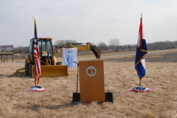
138.7 Construction The site of the improvement is cleared of rock and debris and heavy equipment begins grading. Crews lay pipes under the roadbed to provide drainage and build bridges over other roadways ditches and rivers.
138.8 Road Opening The roadbed is paved with asphalt or concrete. Signs are installed. The road is now complete and ready for travel.
138.9 Road Maintenance MoDOT maintains the facility to meet the needs of travelers. Should the road eventually be found to not meet travelers’ needs, a new “need” will be identified and the process to improve the facility begins again.


Speaking of road maps
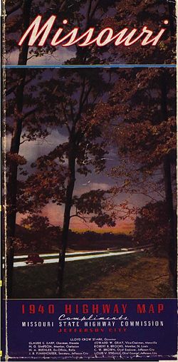
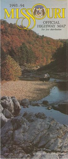
Most common title for MoDOT’s road map: “Missouri Official Highway Map” was used for the 1938 and 1939 editions as well as every one since 1961.
Second most common title: “Official Road Map of Missouri” used for all 11 editions from 1926 to 1936.
Colored ink first used: 1937
Alternative map: The 1989 road map was printed with two versions. One version featured a reverse having no maps but filled with a marketing composition expounding on Missouri’s economic advantages. It was written in English, German, Japanese and Korean.
Maps and metrics: The 1918 road map featured two scales, one in miles and one in kilometers.
Number of times the Gateway Arch has been featured on the cover? 1 (1975)
The state capitol? 8 (including the 1976 cover featuring the previous capitol building completed in 1840 and burned in 1911 when struck by lightning)
Size: The 2007 map is approx. 29 in. x 39.5 in., having an area about 24% larger than most previous maps. Yes, most of the map's print is larger than previous maps' print, too.
How many printed? Over 3 million 2007 maps were printed and distributed, arguably Missouri's most popular state publication.
